

Map Amendment - Wetlands - Southlands SL1
Council is considering a map amendment to Appendix C, Map 4 "Wetlands and Waterways" of the Envision St. John's Development Regulations.
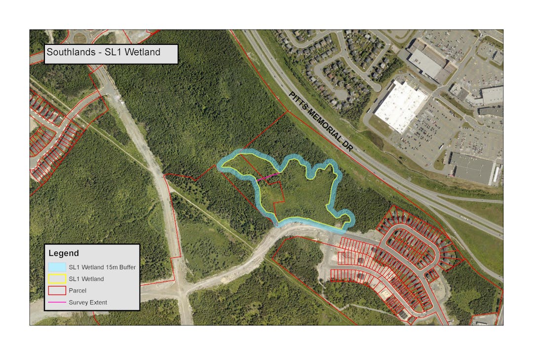
The Southlands SL1 wetland is currently shown as a protected wetland on Map 4; however, the map does not show the full extent of the wetland. The City engaged an environmental consultant to carry out further study of the SL1 wetland and that study identified additional wetland area that meets the Wetland Ecosystems Services Protocol-Atlantic Canada (WESP-AC) criteria set by Council for wetland protection.
The SL1 wetland has expanded and extended further north (area above the pink line shown on the image above). The proposed amendment is to update Map 4 "Waterways and Wetlands" to include this area and reflect the full extent of the Southlands SL1 wetland.
Review the materials on this page and provide your feedback or ask a question.
Return to Planning St. John's main page
Questions
Please use this space to ask questions regarding this application and we will provide an answer. All questions will be posted as submitted. Some questions may require coordination with internal departments and additional time may be needed to post a response.
The Q & A section will remain open while the application is active.
If you prefer to provide comments or questions using mail or email, please do so to the Office of the City Clerk, including your name and address, e-mail cityclerk@stjohns.ca or write to P.O. Box 908, St. John’s, NL, A1C 5M2. Be sure to include the name of the application in your submission.

Thank you for your contribution!
Help us reach out to more people in the community
Share this with family and friends