
FAQs
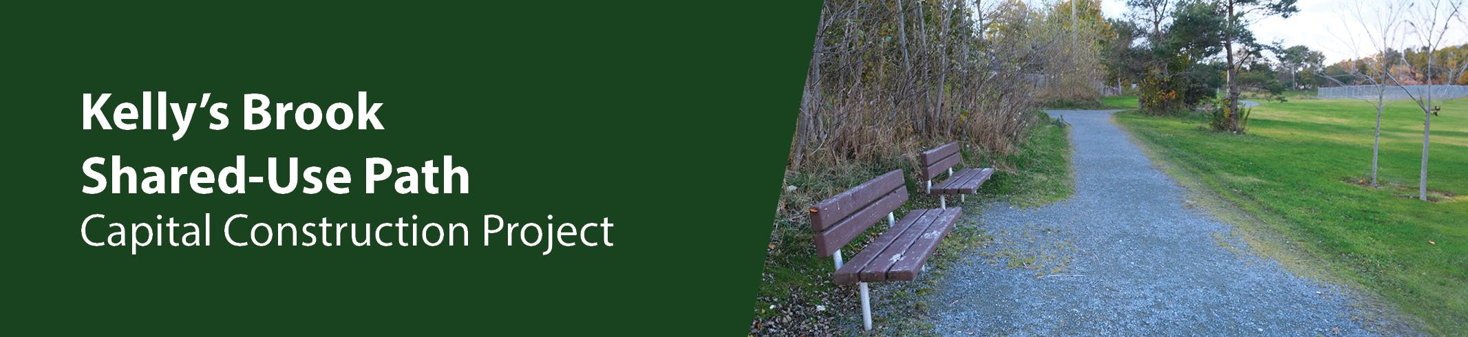
What is a shared-use path?
A shared-use path allows for two-way, off-street pedestrian and bicycle use. People using bikes, scooters, wheelchairs, strollers, skateboards, in-line skates etc. are also welcome on the path. Shared-use paths are frequently found in parks, along rivers, beaches and in greenbelts or utility corridors where there are few conflicts with motorized vehicles.
Construction FAQ
What are the timelines for construction?
The project area will see Kelly's Brook Trail divided into three (3) areas of construction work, namely Phase 1A, 1B and 1C.
Phase 1A will involve the portion of Kelly's Brook SUP between Carpasian Road and Guy Street. Construction on this phase began on November 6 2023, and is anticipated to be completed in the Fall of 2024.
Phase 1B will involve the portion of Kelly's Brook SUP between Bannerman Road and Carpasian Road. Construction of this phase is anticipated to occur during the 2025 construction season.
Phase 1C will involve the portion of Kelly's Brook SUP between Guy Street and Columbus Drive. Construction of this phase began on October 16, 2024 and is anticipated to be completed in the Fall of 2025.
What can we expect to see on the sections of Trail being worked on for Phase 1?
The existing gravel trail will be excavated and graded to receive an asphalt paved surface. Shallow trenching will be conducted along the trail route to install underground electrical conduits, wiring and pole bases to facilitate installation of lighting along the SUP route. There will be some select tree and/or shrub removals and/or tree trimming conducted to facilitate the SUP construction. New trees/shrubs will be planted to replace any necessary tree removals. At locations where the SUP crosses the various streets along the route, there will be sidewalk modifications, crosswalk improvements, and pedestrian bump-outs installed. Various rest areas, benching, waste management bins, wayfinding signage will be installed intermittently along the SUP route. There will be miscellaneous surface drainage systems, and various landscaping reinstatements as well.
Will this project affect the trail along the edge of Rennies River?
No.
As part of the initial work on this project, survey data was collected along the existing trail. This information, combined with preliminary plans for the Rennies River Flood Mitigation berm in the area was assessed. Based on this assessment, it was found that it is not feasible to upgrade/widen the trail in conjunction with the addition of the berm. As such, the preliminary alignment along the river's edge between King's Bridge Road and Portugal Cove Road has been abandoned.
As shown in the maps currently provided, the project is now focused on a trail alignment that follows Empire Avenue for the sections east of Carpasian Road.
What will the trail look like when it is complete?
A copy of the contract drawings have been uploaded to the Documents section for reference.
Where is the money coming from to pay for this project?
Three levels of government are sharing the investment in this project. The Government of Canada is committed to half of the funding. The Government of Newfoundland and Labrador will provide one third, and the City of St. John’s will provide the remaining 17 percent.
“On behalf of Council and staff, we are thankful to our Federal and Provincial partners for this significant investment in City infrastructure. Upgrading Kelly’s Brook Trail is a major step in building an integrated mobility network that will support multiple modes of active transportation in our City. Improved connectivity will provide health and economic benefits for many years to come, and I look forward to breaking ground on this project.” -City of St. John’s Mayor Danny Breen
General SUP questions
Non-stabilized granular (traditional granular trail)
Stabilized granular (Organic-Lock ™)
CORE ™ gravel foundation system
Asphalt
Concrete
- In the context of Kelly’s Brook Trail, a shared-use path is recommended to best accommodate the needs of users of all ages and abilities.
- Shared-use paths encourage people to use active transportation, leading to more active living.
- Sharing pathways helps to build a trail community by increasing the need for all users to cooperate to preserve and protect a common resource. Encountering other users on a trail offers the opportunity to meet and talk, helping to establish mutual respect and courtesy.
Will the trails be paved?
Yes.
The goal of the project is to enhance and upgrade the trail to be accessible for everybody in our community to safely use and enjoy.
The current recommendation to pave Kelly’s Brook trail has many facets but the most important is accessibility. Five (5) different surface material types were evaluated & shared with council and the public for feedback. These included:
Please see the information on the evaluation of these surfaces here: https://www.engagestjohns.ca/kelly-s-brook-trail-catalyst-project-1-bike-master-plan/news_feed/surface-material-memo
Based on the evaluation and feedback, an asphalt surface treatment was ultimately selected for upgrading Kelly's Brook Trail to a Shared- Use-Path. Shared use paved trails are standard in cities world-wide and are constructed to be inclusive for everyone. These trails aim to create a shared space for walkers, cyclists, people who use scooters and wheelchairs, and families who use strollers; all residents deserve the opportunity to use our city trails.
What is active transportation?
Generally speaking, active transportation describes all human-powered forms of travel. This includes people moving on foot (walking, jogging or running) and people using bikes, scooters, wheelchairs, strollers, skateboards, in-line skates and more! Walking and biking are among the most popular and can be combined with other modes, such as public transit. Walking to the store, rolling to school, and biking to the recreation centre are examples of active transportation.
What are the advantages of a shared-use path?
What will the shared-use path look like?
Shared-use paths are designed to provide a safe environment for all; as such, they typically have a 3 metre wide corridor, are paved, and may have a painted dividing line.
The design team is evaluating five surface treatment options for the shared-use path: a standard fine gravel surface, a stabilized gravel surface, a gravel foundation system, and asphalt and concrete surfaces. The following characteristics are being considered: the look and feel of the surface, accessibility and impact on users, environmental sustainability, construction impact and cost, as well as expected lifespan, durability and maintenance requirements. The choice of surface material will be informed by feedback from the engagement process and the design team’s evaluation. Finally, this information and a recommendation will be presented to Council who will make the final decision about surface material.
Why improve active transportation in St. John’s?
Improved Health. When people become more physically active, their mental and physical health improves, increasing productivity, reducing sick days, requiring less medical treatment, and saving healthcare costs. Obesity levels in St. John’s (56.1%) are higher than the national average (24.8%). There is an inverse relationship between obesity and active transportation. Improving active transportation infrastructure impacts obesity outcomes. In addition, Newfoundland and Labrador has the most rapidly aging population in Canada. Living a more active lifestyle is very important for healthy aging.
Recreational Benefit. Improving a city’s active transportation network increases the number of routes that are comfortable not just for commuting and transportation, but also for leisure and recreation.
Environmental Responsibility. In Newfoundland and Labrador, greenhouse gas (GHG) emissions per capita are 4% higher than the Canadian average. In 2016, the use of cars, light trucks, and motorcycles accounted for 17% of the province’s GHG emissions (or 48% of transportation sector emissions). Between 2009 and 2016, Newfoundland and Labrador household transportation emissions increased by 40.9%. In 2018, GHG emissions were 6.08 tonnes per capita in St. John’s, which is above the 2016 provincial average of 5.8 tonnes per capita. Reducing motor vehicle trips helps mitigate climate change through the reduction of GHG emissions.
Livable Streets. When more people use active transportation (AT) instead of drive, there are fewer cars on the road, reducing traffic and congestion on city streets. Physically separated bicycle facilities reduce risks for people bicycling, and when more bicycle infrastructure is available, people perceive it to be safer. There is also safety in numbers; as more people bike, there are proportionately fewer cycling accidents and the rates of collisions with motor vehicles decrease. Livable streets are vibrant, attractive, safe, and welcoming to all people, whether walking, rolling, cycling, or driving. These characteristics support a dynamic economic and social environment, encourages use by the entire community, create a strong sense of place, and foster community pride.
Government Cost Savings. The government savings associated with more people using active transportation outweigh the costs of investing in those facilities. For example, cost-benefit analysis has estimated that a $1 investment in cycling saves the government $14. Shifts to walking and bicycling from urban driving are estimated to save 3¢/km travelled in urban roadway infrastructure and traffic service costs. In terms of healthcare costs, it is estimated that in Canada, the economic costs of physical inactivity are $5.3 billion, and obesity are $4.3 billion.
Personal Financial Benefit. Investing in active transportation facilities makes city transportation more equitable. Overall, transportation accounts for 19.9% of household spending on goods and services in Canada. Spending on transportation is disproportionately high among low-and moderate-income families. For these households, active transportation is an affordable option when cities invest in active transportation and public transit. For example, driving costs on average $9,000 annually, including fuel, maintenance, and insurance. A year of Metrobus passes costs $936. Alternatively, the operating costs of regular cycling are on average, $308 annually. While active transportation cannot replace all types of trips, it can reduce the need for vehicle ownership and be used as part of an integrated mobility network.
Are shared-use pathways safe for both pedestrians and people who bike?
Yes. For the number of people expected to use Kelly's Brook Trail (less than 100 people per hour), a shared-use path is an appropriate facility type for people of all ages and abilities to use. According to the Bike St John's Master Plan, when a trail regularly sees more than 100 people per hour, separation of people biking and pedestrians should be considered.
When sharing a path, all people using the space have responsibilities that maintain each others’ safety. There are many best practices that help minimize user conflict (e.g., maintaining an appropriate speed, using a bell, using lights at night, keeping dogs under control, being aware of more vulnerable users).
Trail users learn about respectfully sharing the pathway by following the signage along the trail and through other educational initiatives (e.g. through City initiatives or trail user groups).